LBRY Block Explorer
Search
LBRY Claims
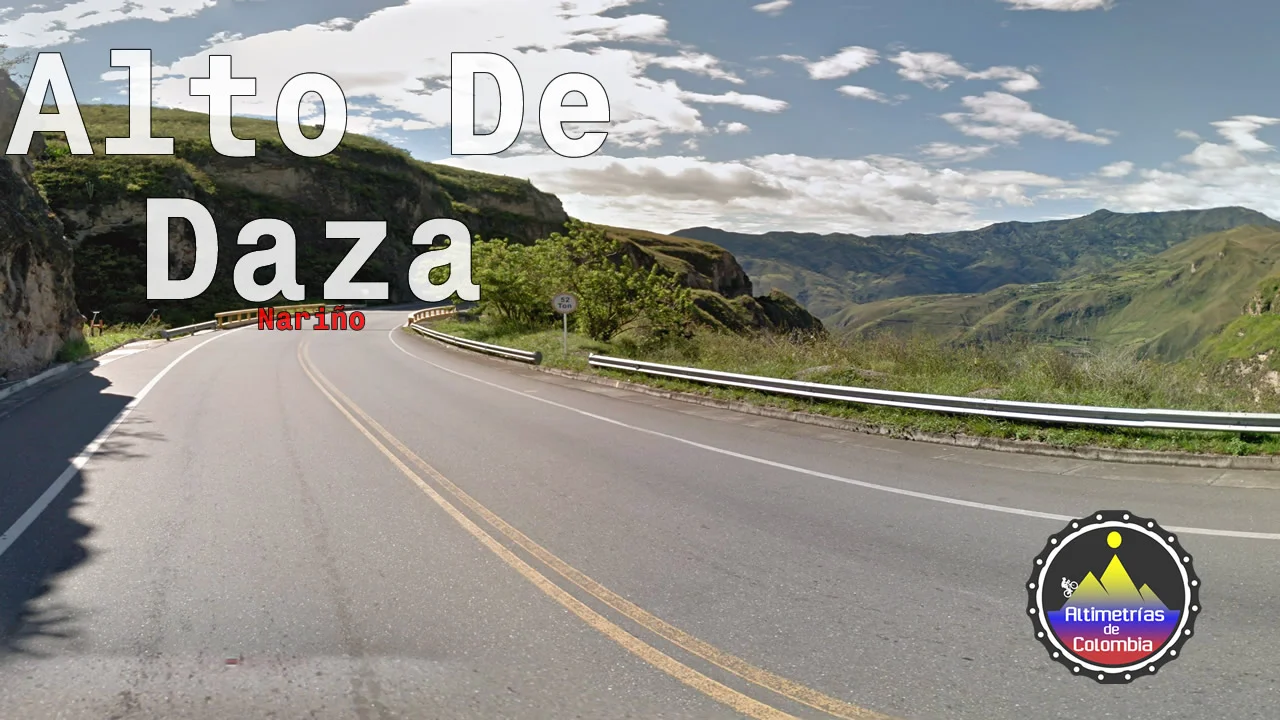
• Alto-de-Daza-desde-Puente-Rio-Juanambu
c8fc1e872493e7de1aaf1ade8f2dfc0e7ae7ff66
Published By
@alticol
Created On
16 Jul 2020 20:46:39 UTC
Transaction ID
e640bfb70839fe0e835222f6ec168c071bc2ac2c3b06aadb974881837c7bc3d3
Cost
Safe for Work
Free
Yes
Alto de Daza desde Puente Rio Juanambú
? **Alto de Daza desde Puente Rio Juanambú:**
**Nariño**
----
> ? 39.4 kms
> ? 4.9 %
> ❗ 12%
> ⛰ 2823 m.s.n.m.
------
*Mas Info:*
*
https://bit.ly/3fEpzlR*
Author
Content Type
Unspecified
image/jpeg
Language
English
Open in LBRY
More from the publisher
Controlling
IMAGE
FILAN
Filandia-Desde-Quimbaya
lbry://@alticol/Filandia-Desde-Quimbaya
? Filandia Desde Quimbaya: ------------- ? 14.1 kms ? 4.1 % ❗ 18% ⛰ 1920 m.s.n.m. ----------- Mas Info: http://bit.ly/2ITam3N
Transaction
Created
1 month ago
Content Type
Language
image/jpeg
English
Controlling
IMAGE
ALTO
Alto-Carniceros-(Córdoba)
lbry://@alticol/Alto-Carniceros-(Córdoba)
? **Alto Carniceros por Córdoba:** ---- >**Quindío** > ? 13.1 kms > ? 6.7 % > ❗ 16% > ⛰ 2018 m.s.n.m. ----- *Mas Info:* https://bit.ly/32mWx6k
Transaction
Created
1 month ago
Content Type
Language
image/jpeg
English
Controlling
IMAGE
ALTO
Alt-de-Buenavista-desde-caicedonia
lbry://@alticol/Alt-de-Buenavista-desde-caicedonia
? **Alto De Buenavista:** > **Quindío** > ? 7.3 kms > ? 6.7 % > ❗ 21% > ⛰ 1639 m.s.n.m. *Perfil Actualizado, antiguo en este link:* https://altimetriascolombia.blogspot.com/2014/02/el-crucero-el-coloso-que-asciende-de.html
Transaction
Created
1 month ago
Content Type
Language
image/jpeg
English
Controlling
IMAGE
ALTO
Alto-de-Patios-desde-Bogotá
lbry://@alticol/Alto-de-Patios-desde-Bogotá
? **Alto De Patios:** ----- > **Bogotá** > ? 6.6 kms > ? 6.3 % > ❗ 11% > ⛰ 2996 m.s.n.m. ------ *Mas Info:* https://bit.ly/30ldn2U
Transaction
Created
1 month ago
Content Type
Language
image/jpeg
English
Controlling
IMAGE
ALTO
Alto-Los-Curos
lbry://@alticol/Alto-Los-Curos
? **Alto Los Curos desde Puente Pescadero :** > ? 14.9 kms > ? 4.6 % > ❗ 16% > ⛰ 1232 m.s.n.m. *Mas Info:* http://bit.ly/2k5T0pu
Transaction
Created
1 month ago
Content Type
Language
image/jpeg
English
Controlling
IMAGE
ALTO
La-Linea-desde-Cajamarca
lbry://@alticol/La-Linea-desde-Cajamarca
? **Alto de la Línea desde Cajamarca* (Perfil Actualizado)*:** > **Cajamarca** > ? 23.2 kms > ? 6.3 % > ❗ 14% > ⛰ 3285 m.s.n.m. *Mas Info:* https://bit.ly/3fFibXq
Transaction
Created
1 month ago
Content Type
Language
image/jpeg
English
Controlling
IMAGE
ALTO
La-Mona-Desde-Peaje-bicentenario
lbry://@alticol/La-Mona-Desde-Peaje-bicentenario
? **Alto La Mona Desde Peaje bicentenario :** > ? 16.8 kms > ? 5.5 % > ❗ 16% > ⛰ 1236 m.s.n.m. *Mas Info:* http://bit.ly/2kqEgSa
Transaction
Created
1 month ago
Content Type
Language
image/jpeg
English
Controlling
IMAGE
LA TR
La-Tribuna-desde-bituima
lbry://@alticol/La-Tribuna-desde-bituima
? **La Tribuna desde Bituima :** ------- > ? 28.8 kms > ? 5.6 % > ❗ 12% > ⛰ 2716 m.s.n.m. ------ *Mas Info:* https://bit.ly/30cD5qp
Transaction
Created
1 month ago
Content Type
Language
image/jpeg
English
Controlling
IMAGE
ALTO
Alto-Buenavista-desde-glorieta-la-grama
lbry://@alticol/Alto-Buenavista-desde-glorieta-la-grama
? Alto de Buenavista desde Villavicencio : ----- ? 9.0 kms ? 8.0 % ❗ 14% ⛰ 1158 m.s.n.m. ------ Mas Info: http://bit.ly/30jdU4L
Transaction
Created
1 month ago
Content Type
Language
image/jpeg
English