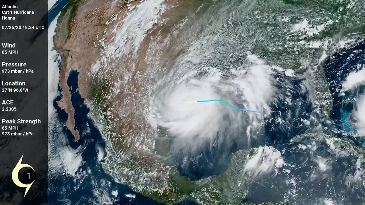
The first hurricane of the 2020 Atlantic Hurricane season. Hanna broke the record for the earliest 8th storm. It broke the previous record held by Harvey of 2005 by 10 days.
Peak: 85 MPH (90 MPH from non 6-hour update sources), 973 mbar / hPa.
Tropical Storm Dolly was the fourth named storm of the 2020 Atlantic hurricane season. Initially subtropical, Dolly briefly held tropical status for nearly 24-hours while the center of circulation was over the Gulf Stream. Upon leaving the stream, the storm weakened and its center was left exposed.
Peak: 45 MPH, 1002 mbar / hPa
Tropical Storm Rene was the eighteenth tropical system and the seventeenth named storm of 2020. Slow moving and constantly under attack by wind shear and dry air, Rene never strengthened below 1000 mbar of pressure.
Peak: 50 MPH, 1000 mbar / hPa
Tropical Storm Bertha was the second named storm for 2020 in the Atlantic basin. This is the second pre-season storm as the season does not officially kick off until June 1st.
Peak: 50 MPH, 1007 mbar / hPa.
Tropical Storm Edouard was the fifth named storm of the 2020 Atlantic hurricane season and the earliest fifth since reliable records began. Another short-lived system, Edouard maintained tropical storm status for less than 24 hours.
Peak: 45 MPH, 1005 mbar / hPa
Hurricane Isaias was the ninth storm of the 2020 Atlantic Hurricane season, and the earliest one on record. At this time, Isaias is responsible for 13 fatalities and an unknown amount of damages. Areas affected include West Africa, the Lesser Antilles, the Greater Antilles, the Bahamas, the entire East Coast of the United States, and Eastern Canada.
Peak: 85 MPH, 987 mbar /hPa.
Tropical Storm Omar was the fifteenth tropical system and fifteenth named storm of the hyperactive 2020 Atlantic Hurricane Season. The storm that would become Omar became a tropical depression first, being given the numerical identifier 15L. However, the depression didn't strengthen to tropical storm status until after 16L. Thus, 15L received the later 'O' name and 16L received the 'N' name.
Omar affected no land directly while tropical, but did make landfall as an extratropical system over Scotland.
Peak: 40 MPH, 1003 mbar / hPa
Major Hurricane Laura was the thirteenth tropical system and twelfth named storm of the 2020 Atlantic hurricane season. Laura was the earliest forming twelfth storm in recorded history. When the storm became a tropical depression, it did so around the same time as another tropical depression formed (later Hurricane Marco). At one point, both storms were predicted to make simultaneous landfalls on the US Gulf states as category 1 hurricanes. Laura remained under hurricane strength until reaching the Gulf of Mexico. Upon entering those water, rapid intensification quickly created a category 4 monster of a storm.
Laura made landfall near Cameron, Louisiana, just 1 mbar / hPa above its peak lowest pressure and tied the 1856 Last Island Hurricane as the strongest (deepest low pressure) to hit the US state of Louisiana.
As of August 31st, Major Hurricane Laura is estimated to have caused US$8 billion in damages.
Peak: 150 MPH, 937 mbar / hPa.
Tropical Storm Theta was the thirtieth tropical system and the twenty-ninth named storm of the hyperactive 2020 Atlantic hurricane season. At 29 storms, this now bests the 2005 hurricane season as the most active. 2005 reached its last storm on December 30th.
Theta began as a area of low pressure that had detached from a front that had began dying out over the central Atlantic. Once the circulation had completely closed off, Subtropical Storm Theta was born. Never a threat to land and with very little chance of strengthening, Theta moved eastward over the Atlantic without much fanfare other than eventually transitioning to a fully tropical system.
Peak: 70 MPH, 989 mbar / hPa.
Tropical Storm Kyle was the 12th tropical system and 11th named storm system of the 2020 Atlantic hurricane season. Kyle began as a storm system over eastern North Carolina where officials began keeping an eye on it. Once over the Gulf Stream, the storm gained Tropical characteristics and became a Tropical Storm.
The system struggled against shear from the get-go. While the circulation was closed, most of its center was exposed through vast parts of the storm's life. As quickly as it popped up, it disintegrated.
Peak: 50 MPH, 1000 mbar / hPa.